
Maryville ZIPs at a Glance
Official county and local-government addresses show four Maryville mailing ZIPs: 37801, 37802, 37803, and 37804. The USPS historical destination table groups 37801 through 37804 under Maryville 37801 for the cited routing table. That is a postal grouping, not a set of four city districts. The safe postal-directory reading is therefore address-specific: use the full address for a current postal answer, and preserve the exact printed label in historical records.
| ZIP | Areas covered | Post office | Record note |
|---|---|---|---|
| 37801 | Central, west, south, and county-associated addresses may use it | Maryville postal grouping | Exact neighborhood split was not verified. |
| 37802 | Maryville mailing addresses and local-organization addresses | No verified station assignment | Current delivery versus PO Box split was not located. |
| 37803 | Maryville-area mailing addresses in local government and community records | No verified station assignment | No exact city-limit polygon was verified. |
| 37804 | Courthouse and county-department mailing addresses, plus city and unincorporated county addresses | No verified station assignment | It is not a test for city jurisdiction. |
The Maryville ZIP directory should not assign a subdivision or a boundary to any row above. Official records also use nearby postal places such as Alcoa, Friendsville, Louisville, Rockford, and Townsend. A Maryville postal label can serve an address outside the incorporated city, while city and county records may still use the same postal geography.
Maryville ZIP Labels Are Not Districts
A ZIP code is a mail-routing label. A parcel is a county land-record unit. An E-911 address supports emergency-address assignment. A city boundary identifies municipal jurisdiction. Those layers may overlap, but they are not interchangeable. This is the central limit of a Maryville ZIP lookup: a matching mailing city does not prove that an address is inside Maryville city limits or that city services govern the parcel.
For a jurisdiction question, compare the address in USPS, the parcel in TPAD, and the available city-boundary material. The research identified Tennessee's administrative city-boundary service, but the Blount GIS live viewer timed out, so its ZIP layers and controls are not verified. Use the documented result as a layer-specific finding, such as “parcel appears inside the city boundary according to the cited layer and date,” rather than relying on a ZIP alone.
Note: The same road can have a postal identity, a parcel identity, an E-911 address, and a municipal-service identity.
Confirm a Maryville ZIP With USPS
The USPS ZIP Code Lookup is the address-level authority for an exact current mailing ZIP. Enter the full street address rather than assuming that a city name or a nearby county office determines the result. The research inspection did not capture a live Maryville city result or current delivery-boundary polygon, so the lookup should be run again for the specific address being checked.
The USPS city and state lookup is the official starting point for a Maryville ZIP reference.
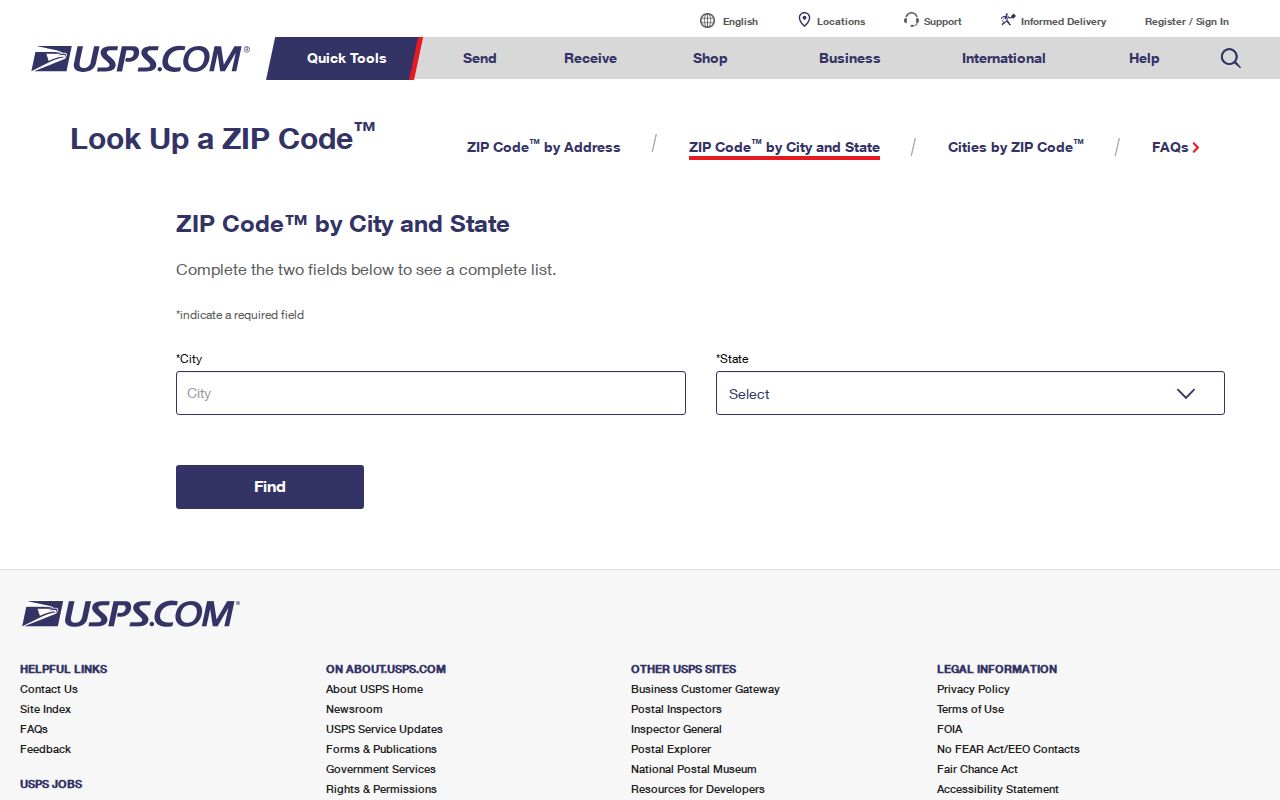
Save the returned ZIP with the date of the lookup, then compare it with the address strings used by county and city custodians.
For a historic letter, directory, deed, or newspaper notice, copy the postal wording as printed. A modern USPS result can normalize an address for a current search, but it cannot rewrite the historical document or establish the ZIP that was in use at an earlier date.
Search Maryville ZIP Records
A Maryville ZIP search works best as a chain of small checks. USPS confirms delivery information for one address. The parcel record adds a situs and identifier. A map or city-boundary layer can address jurisdiction. GoVote can check a known voter or address for election context. None of those tools offers a verified public ZIP-wide list of everyone associated with a mailing area.
- Run the complete address through USPS and save the returned ZIP and access date.
- Search the same address in TPAD, retaining the situs address and control map, group, and parcel fields.
- Open the TPAD GIS Map link or Blount GIS to compare parcel geography. Exact GIS ZIP and boundary controls were not captured, so do not assume a layer is available.
- Use GoVote for a known name or exact address when precinct and polling information are needed.
- When the ZIP narrows the search to a street, continue with the address chain in the Maryville street directory rather than treating the ZIP as a property-record search field.
The County Archive Center can search by keyword, category, and date range, but no ZIP-wide resident filter was documented. A targeted city or county request should ask for existing records by address, record type, and date. It should not ask an office to compile a new ZIP roster.
Maryville ZIP Fields in GoVote
GoVote exposes ZIP fields in both its voter and address modes. In voter mode, the first and last names are required and ZIP is optional. Address mode includes street address and ZIP inputs, but two select controls and a third control were not labeled in the inspection. Do not guess their meaning. The portal promises a match's sample ballot, polling location, elected officials, and other voter information sourced from county election commissions.
| GoVote field | Type | Required | Verified scope |
|---|---|---|---|
| First Name | Text | Yes, voter mode | Use exact registered spelling with last name. |
| Last Name | Text | Yes, voter mode | ZIP can optionally narrow the known-name query. |
| ZIP Code | Text | No in voter mode | It is not a replacement for county selection. |
| Street Address and ZIP Code | Text | Not exposed | Address mode returns voter and polling context, not a ZIP population list. |
County commissions provide the portal data and apply redistricting changes as received. A returned result should be described by the record elements displayed on the date searched. A no-match does not establish that a person never lived at the address, and a match does not establish every person connected with the ZIP.
Maryville Parcels Behind ZIP Results
TPAD is useful after USPS because it treats a Maryville address as a property record rather than a mailing-zone record. Basic search requires selecting the county and entering a search term. Advanced search allows owner name, property address, subdivision name, classification, a sale-date range, and control map, group, and parcel fields. The property-address example is Main St, with the street number optional. No verified TPAD ZIP filter was exposed.
Results can include Owner, Property Address, Control Map, Group, Parcel, Parcel ID, Subdivision, Lot, Class, Sale Date, and GIS Map. The owner display and mailing address must stay separate from the situs address. They may point to different places. This makes TPAD a careful companion to a Maryville postal reference, not a way to generate a ZIP-wide list of current people.
Note: When a ZIP and a parcel record seem inconsistent, keep both source labels and ask the relevant custodian which field governs the question.
Maryville City Limits and E-911
Blount County E-911 is the address-assignment authority named in Maryville's residential-construction material. The research gives 865-981-7113 and hours of 8 a.m. to 3 p.m., Monday through Thursday. For city-regulated work, compare the address with the Tennessee city-boundary layer and ask Maryville Codes or Engineering about the specific address and work date. County assessment, tax, and deed matters remain with Blount offices even when the parcel is in the city.
- ZIP code
- A USPS routing label for delivery. It is not a municipal-boundary record.
- ZIP+4
- An added delivery segment used with a ZIP to narrow mail routing for a more specific address range or delivery point.
- PO Box ZIP
- A ZIP associated with post-office-box delivery. The research did not verify a current Maryville delivery versus PO Box split for 37802.
- Unique ZIP
- A ZIP used for one organization or facility. No verified Maryville unique-institution ZIP was located.
- Carrier route
- A postal delivery grouping. It is not a city-limit, precinct, or parcel boundary.
The inspected sources did not document a Maryville quadrant numbering rule, street-renumbering project, or annexation readdressing map. Those details remain a research gap until an E-911 or municipal record verifies them.
Maryville Records Before ZIP Use
Historic Maryville searches should begin with the address language used in the document, not a modern ZIP. The verified Alcoa-with-Maryville city-directory editions are 1923, 1929/30, 1941, 1943, 1948, 1952, 1953, 1959, 1965, 1990, and 1991. They are snapshots with large gaps. An absent listing in an unrepresented year is a source gap, not proof that a person was absent.
For a 1953 address question, preserve the printed street and place label, then compare the 1953 directory with the 1948 and 1959 editions. The 1925 Maryville Sanborn map can provide structure and street context, while deed book/page, tax-roll, archive, and newspaper records add other kinds of evidence. A Sanborn sheet does not name the people at a location.
The county Archives, library, TSLA microfilm, Virtual Archives, and local historical sources are the fallback channels for older address strings. Their collections should be requested by title, year, page, record type, and date range, because none was documented as a ZIP-wide historical resident index.
Limits of a Maryville ZIP Code Directory
No verified modern ZIP split or realignment table was located for Maryville. Nor did the inspected sources provide a current USPS delivery-boundary polygon, a neighborhood-by-ZIP table, a ZIP population table, or registration statistics. The lack of a verified split is useful information: do not invent local delivery boundaries from a general map, a mailing label, or an older directory.
One ZIP label, a parcel owner, a GoVote result, or a historical directory entry is not a complete account of who is presently connected with an address. Use postal, parcel, city, and historical sources only for the specific question each can answer. For a city record, Maryville's public-record route can be narrowed by address and date; for county property questions, use the Assessor, Register, or Archives as the record holder requires.
Use records carefully. A Maryville ZIP or address result supports lawful, specific research only. Never use it to stalk, harass, intimidate, or harm another person.
Note: Keep USPS, E-911, parcel, and city-boundary findings in separate fields so a later reader can see which source supports each conclusion.